Our features
We offer a complete range of services including imagery acquisition & processing, and value-added products
High-tech equipment
We own high-resolution image acquisition tools (i.e. drones) to cover visible area, multi-spectal, and thermal detection.
Fast and effective engineering consulting company
We can send you a quote within 24 hours
International experience
Fast deployment on faraway territories in all conditions including crisis and post-crisis management
Multi-disciplinary applications
Our team of experts has a long track record in the various domains.

About us
Geomatic Development is a young and innovative company
Created in 2009, Geomatic Development is a young and innovative company. Its founder, John Clerin, is a field geographer expert in geomatics and spatial analysis. team professional experience in a variety of diciplines with a mastery of geomatic tools. We offer all services related to geospatial activities by controlling the entire production line in geographic information: acquisition, integration, processing, analysis and representation. In 2014, our company has acquired drone and the latest software in image processing to better meet the needs of its customers. We work in Europe and all over the world, particularly in South-East Asia, and many : agriculture, hydrology, environment issues, urban planning , archeology ... Geomatic Development is firmly committed to innovation through partnerships with research centers and universities.
Worldwide missions
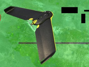
Drone
Bespoke data acquisition
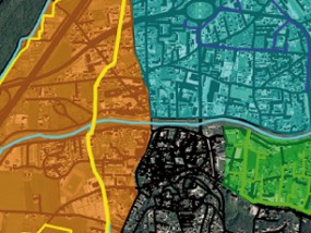
Geographical information
Multi
From quarries to South-East Asia rice fields


Our team
Complementary skills with a long track record in the various domains of geographical information

JOHN CLÉRIN

JULIAN CRESPO

ORIANE WARUSFEL
JEAN-MATTHIEU BUTON

DAVID TRICOT
Contact us
News
Our current projects involving UAV geographical data acquisition and analysis
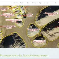
Accurate Volume Measurement – The Reason why half of the largest mining companies Use PIX4D mapper – A GEOmatic Development case
Drone Photogrammetry for Stockpile Measurement The biggest 40 mining companies were announced in PWC’s latest mining report, and nearly half of these companies use drone photogrammetry software (Pix4Dmapper Pro) as part of their mining workflow. Managing stockpile inventory, that is, finding a solution for accurate volume measurement and easy inventory management, is one of the[…]

Tech and bio : The professional show on organic and alternative farming techniques
In partnership with the Chambers of Agriculture , Geomatic Development will participate in the Bio Tech show on September 24 for a demonstration of the use of his image acquisition tools in agriculture http://www.tech-n-bio.com/home.html
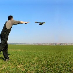
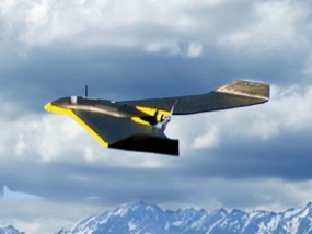
Why this type of drone?
Why have we chosen this particular type of drone? We strive to personalise image acquisition and in that respect the advantages of the drone seemed clear. Yet, in this fast moving area, we had choices to make in order to fit the needs of geographical data and cartography. Flying wing drones offer a greater flight[…]

Collaboration with Jean Nouvel architectural practice
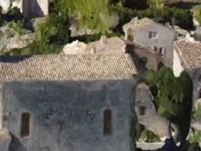
In November 2014 our company provided the major architectural practice Atelier Jean Nouvel with a very high resolution ortho-photography and a points cloud. These geographical data have been delivered to the architects who then were able to study the impact of a building project in Le Muy, near Draguignan, in the Var region. This project[…]
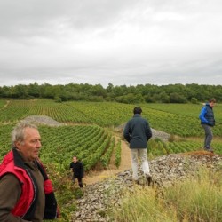
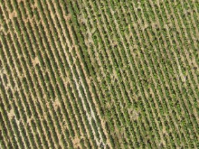
Vineyards – European VINTAGE project
Our missions in precision farming lead us to collaborate with the European Research Project VINTAGE, http://www.vintage-project.eu/. This project is a collaboration between universities, research units and thousands of professional wine producers. The aim of this project is to make available to these producers a web-based integrated solution to optimize the vineyard life cycle from planting[…]